Geophysical Services
Basin and Exploration Studies
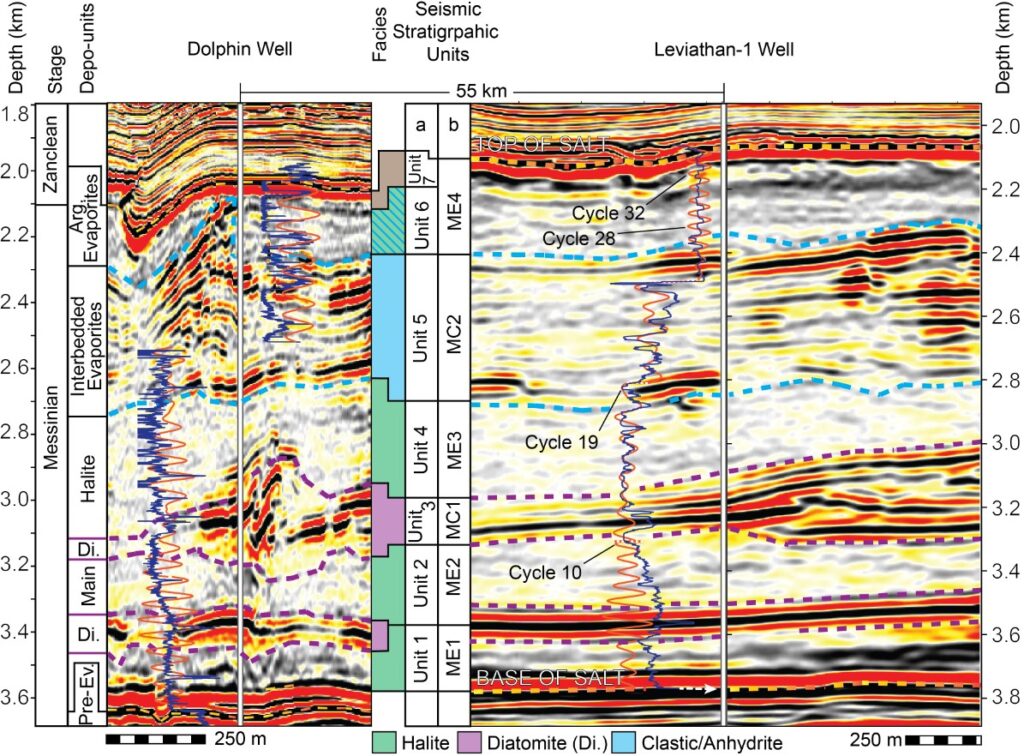
Exploration geophysics is a vital tool in the search for subsurface resources, combining geophysical techniques with geological interpretation to reveal the structure and composition of the Earth’s crust. Using methods such as seismic, gravitational, magnetic, electrical, and electromagnetic surveys, we can detect anomalies that indicate the presence of valuable geological formations.
At Floodhound, we specialize in comprehensive basin analysis and advanced exploration studies. Our expertise includes:
Our approach helps clients assess resource potential, reduce exploration risk, and build reliable geological models that guide investment and development.
Seafloor Geohazards and Geotechnical Studies
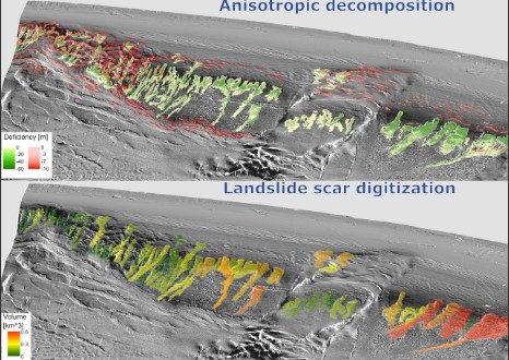
Advances in full-coverage geophysical seafloor mapping over the past two decades have significantly enhanced our understanding of marine geohazards. These hazards — including submarine landslides, gas seeps, faulting, and sediment instability — pose potential risks to offshore infrastructure and coastal populations.
At Floodhound, we conduct detailed geohazard assessments that support safe offshore development. Seafloor mapping serves as the foundation of this work, providing the only comprehensive method for identifying and classifying geohazard-prone areas across broad offshore regions.
Our services include:
These assessments are essential for responsible planning in offshore energy, cables and pipelines, and coastal development projects.
Marine technologies
At Floodhound, we work closely with leading research institutions to apply advanced marine technologies in the study of the seafloor and offshore infrastructure. These tools allow for high-resolution data acquisition in environments that are otherwise difficult to access.
Our operations routinely incorporate:
This integrated approach provides high-quality datasets that support geohazard assessments, environmental monitoring, infrastructure planning, and scientific discovery beneath the waves.