Hydrological Modeling
&
Flood Hazard Mapping

Urban Flood Modeling

Urban areas are uniquely vulnerable to intense rainfall events due to high impervious surface coverage and complex drainage networks. At Floodhound, we use high-resolution elevation models and drainage infrastructure data to simulate how water moves through streets, buildings, and green spaces. Our modeling identifies critical flood zones, flow pathways, and ponding areas — helping planners and city engineers take proactive steps.

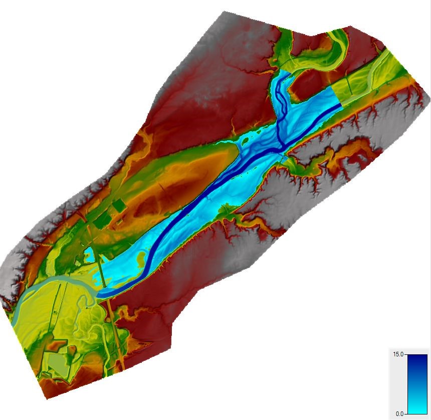
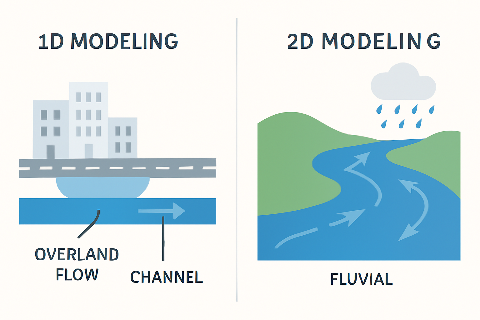
Fluvial (River) Flood Modeling

River systems can pose significant flood risks, especially when combined with rapid snowmelt, heavy upstream rainfall, or dam releases. We model fluvial systems with careful attention to river geometry, floodplain dynamics, and upstream catchment characteristics. This is especially valuable for rural municipalities, infrastructure along rivers, or integrated watershed planning

1D vs. 2D Hydraulic Modeling

1D modeling simplifies flow into channels or pipes — excellent for quick assessments or long linear systems like rivers and drainage channels.
2D modeling accounts for flow across surfaces — essential for simulating water movement in urban environments, over land, or in basins with complex topography.

Fluidit Storm: Our Main Tool

When to Use HEC-RAS

We primarily use Fluidit Storm, one of the most advanced stormwater and urban flood modeling tools on the market. It allows for:

  • Full 2D overland flow simulation

  • Real-time input from rainfall sensors

  • Integration with GIS and BIM

  • Scenario modeling for future climate conditions

Its intuitive interface and simulation power allow us to deliver results faster and tailor mitigation strategies precisely.

HEC-RAS, developed by the US Army Corps of Engineers, is ideal for fluvial systems and large-scale riverine projects. While less suited for dense urban modeling, it’s robust for simulating river flows, floodplain mapping, and backwater effects. Floodhound uses HEC-RAS when the project involves dam breaches, bridge hydraulics, or rural floodplain planning.

Ready to Plan Smarter?
Let’s Talk